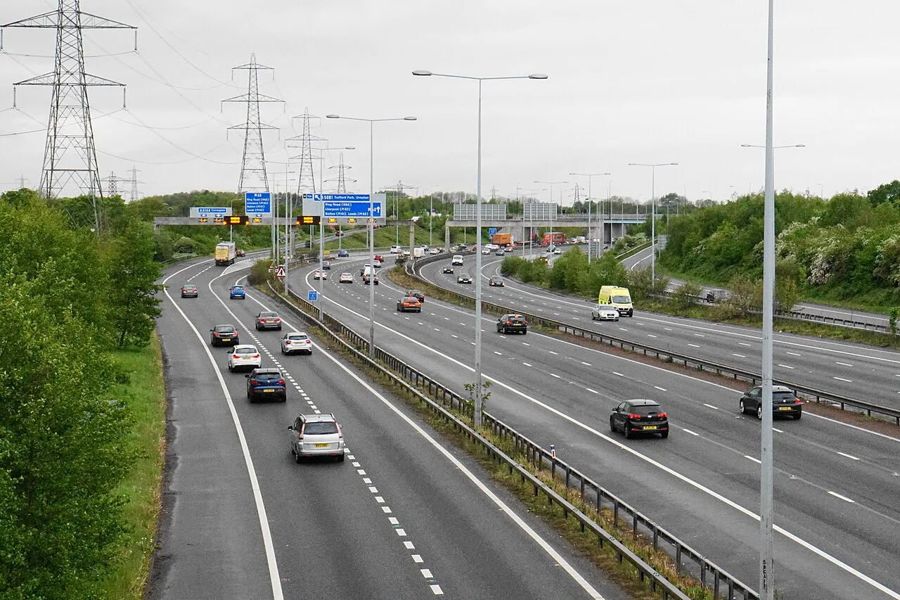

The M56 eastbound exit at Bowdon shuts tonight, Friday and Monday. Deansgate Lane in Timperley is closed to 19 October, the day the trams stop for two weeks.
The M56 eastbound exit at Bowdon, junction 7, is shut overnight tonight, Friday and Monday. On all three nights the whole eastbound carriageway from the M6 at Lymm to Bowdon is shut as well.
In town, Deansgate Lane in Timperley is closed to traffic until 19 October for United Utilities work. Church Street, the A56 through the town centre, loses a lane from Sunday 4 to Wednesday 7 October.
On the trams, Altrincham services still miss Piccadilly Gardens and Piccadilly until Friday 2 October. The two-week shutdown of the whole line starts on Monday 19 October.
Everything here comes from National Highways’ seven-day closure report starting 30 September, the Greater Manchester road works register, the DfT Street Manager permit record and TfGM’s own pages.
Checked on 1 October 2026.
This week at a glance
| When | What |
|---|---|
| Tonight, Thursday 1 October, 10pm to 6am | M56 eastbound shut from junction 9 (Lymm) to junction 7 (Bowdon), and the junction 7 exit slip |
| Until Friday 2 October | Altrincham to Bury trams run via Market Street but miss Piccadilly Gardens and Piccadilly |
| Friday 2 October, 10pm to 6am | M56 eastbound junction 9 to 7 and the junction 7 exit slip, again |
| Saturday 3 October | Super League Grand Final at Old Trafford |
| Saturday 3 October, 11pm to 6am | M56 westbound junction 7 exit slip (Bowdon) |
| Sunday 4 October | Manchester Half Marathon in Manchester and Trafford; Chester Road event closure in Stretford |
| Sunday 4 October, 9pm to 5am | M56 westbound junction 7 exit slip, again |
| Sunday 4 to Wednesday 7 October | Lane closure on Church Street, Altrincham |
| Monday 5 October, 10pm to 6am | M56 eastbound junction 9 to 7 and the junction 7 exit slip |
| Until Monday 19 October | Deansgate Lane, Timperley, closed |
| Monday 19 October to Sunday 1 November | No trams at all on the Altrincham line |
The M56 at Bowdon: which nights
National Highways is rebuilding carriageway on the M56 between junction 9 and junction 6, the stretch from the M6 at Lymm past Bowdon to Hale. Junction 7 is Bowdon, where the A56 comes down from Altrincham. Junction 6 is the A538 for Hale and Wilmslow.
If you drive home to Altrincham from the M6 late at night, these are your nights:
| Night | Closure | Times |
|---|---|---|
| Thursday 1 October | Eastbound carriageway junction 9 to 7, and the junction 7 exit slip | 10pm to 6am |
| Friday 2 October | Eastbound carriageway junction 9 to 7, and the junction 7 exit slip | 10pm to 6am |
| Monday 5 October | Eastbound carriageway junction 9 to 7, and the junction 7 exit slip | 10pm to 6am |
| Tuesday 6 October | Eastbound carriageway at junction 7, between the exit and entry slips | 10pm to 6am |
On the Tuesday the slips stay open. Traffic leaves at the exit slip and rejoins at the entry slip, so you can still come off for Bowdon.
On the same nights the M6 southbound link onto the M56 eastbound is shut: Thursday 1 October from 9pm, and Monday 5 October from 10pm. On Friday 2 October the closure covers the links from the M6 southbound onto the M56 in both directions, from 9pm to 6am.
The westbound side has two shorter closures at Bowdon:
- Saturday 3 October, 11pm to 6am: westbound junction 7 exit slip, with the junction 8 entry slip, for drainage work between junctions 7 and 9.
- Sunday 4 October, 9pm to 5am: westbound junction 7 exit slip, for barrier work between junctions 6 and 7.
National Highways’ report lists the closures but not the diversion routes for this scheme. Expect a signed diversion via the next junction (National Highways road closure report).
The M6 at Lymm and Warrington
The M6 southbound between junction 21a and junction 20 is shut overnight tonight, Thursday 1 October, 9pm to 6am. The junction 21 exit and entry slips at Warrington are shut on the same night. That is the carriageway rebuild running from the M62 interchange down to Lymm.
Coming down from Preston or Wigan tonight, the A56 through Lymm and Heatley is the obvious way round, and it will be busier than usual.
The M60: quiet at our end
Nothing is listed on the M60 between junction 5 and junction 10 this week. The nearest closures are the clockwise junction 11 entry slip at Eccles, for barrier repairs, on Friday 2 October (9pm to 10am), Sunday 4 October (5am to 10am) and Monday 5 October (9pm to 6am). The junction 3 slips, at the A34, are shut most nights for drainage (National Highways road closure report).
What is closed on Altrincham’s own streets
The Greater Manchester road works register shows the works that actually shut a road, which the Street Manager list does not flag well. Around Altrincham, Hale and Timperley these are the ones that matter now:
| Road | Area | What | Booked dates | Who |
|---|---|---|---|---|
| Deansgate Lane | Timperley | Road closed | 7 September to 19 October | United Utilities Water |
| Hall Avenue | Timperley | Road closed | 17 September to 9 October | United Utilities Water |
| Hawley Lane | Hale Barns | Road closed | 17 September to 7 October | Cadent Gas |
| Broad Lane | Hale Barns | Road closed | 30 September to 27 October | Cadent Gas |
| Bankhall Lane | Hale Barns | Multi-way lights | 28 September to 9 October | Cadent Gas |
| Church Street | Altrincham | Lane closure | 4 to 7 October | Trafford Council |
| Bloomsbury Lane | Timperley | Road closed | 5 to 7 October | Trafford Council |
| Park Road | Hale | Road closed | 8am 5 October to 5pm 9 October | Trafford Council |
Sources for each row: Deansgate Lane, Hall Avenue, Hawley Lane, Broad Lane, Bankhall Lane, Church Street, Bloomsbury Lane, Park Road.
Deansgate Lane and Hall Avenue are the pair to know if you drive between Timperley and Broadheath. Both are United Utilities repair jobs logged as major works. Deansgate Lane’s permit has been running since 7 September.
Hale Barns has three Cadent Gas jobs within a few hundred metres of each other, on Hawley Lane, Broad Lane and Bankhall Lane. Broad Lane’s closure runs the longest, to 27 October.
Church Street is the A56 through Altrincham town centre. Trafford Council has booked a lane closure there from Sunday 4 to Wednesday 7 October for highway improvement works.
Coming up after that:
- Monday 5 October to Friday 18 December: Trafford Council works on Aimson Road East and Shaftesbury Avenue in Timperley. Aimson Road East is booked as a road closure and Shaftesbury Avenue as multi-way lights, for eleven weeks (Aimson Road East, Shaftesbury Avenue). The register calls them highway improvement works. The council has published nothing else about them that we could find.
- Monday 12 to Wednesday 14 October: United Utilities closes Eaton Road in Bowdon and Green Drive in Timperley.
- Monday 12 to Friday 16 October: a lane closure on Manchester Road at Broadheath for a mobile crane, and lights on Oldfield Road for an Electricity North West connection.
What is only a permit, not a closure
The Street Manager list for Altrincham itself is down to 12 records, from 16 on 21 September. Not one of the twelve requires a traffic order (Street Manager register).
Most of them do not touch the traffic at all:
- Railway Street: a scaffolding licence that ends on Friday 2 October (permit ARN-4245-53423342).
- Greenwood Street, Shaws Road and Cross Street: four Trafford Council standard permits from Tuesday 29 September, with no traffic order (permit NB30097747112-01).
- Welman Way: a United Utilities urgent job since Thursday 24 September, no traffic order (permit HZ72102528879-01).
- Richmond Road: a minor Trafford Council job, booked to finish tonight.
- Blenheim Close, Bowdon: a minor BT job.
Four more entries on Shaws Road (two), Greenwood Street and Oxford Road are booked for a full year, to 30 March 2027, and logged only as “other”. They have never closed anything.
Oldfield Road’s three permits, the busiest cluster in our last update, have all gone from the list.
Old Trafford and the half marathon this weekend
Two big events in the borough this weekend sit on the Altrincham line or near it. TfGM’s events list shows:
- Saturday 3 October: the Super League Grand Final at Old Trafford.
- Sunday 4 October: the Manchester Half Marathon, listed as “Manchester and Trafford”.
- Saturday 10 October: Manchester United v Spurs at Old Trafford (TfGM events).
Trafford’s own record on the road works register carries an event road closure on Chester Road in Stretford for Sunday 4 October (register entry). We could not reach a first-party list of the half marathon’s full road closures today. Manchester City Council’s closures page returned an error. So we are not repeating the lists other outlets have published. If you are driving north through Sale or Stretford on Sunday morning, allow extra time or take the tram.
This week: Altrincham trams still miss Piccadilly
Until Friday 2 October, works at Piccadilly Gardens mean no trams run between St Peter’s Square or Market Street and Piccadilly. For that week:
- Altrincham to Bury trams run via Market Street.
- They do not call at Piccadilly Gardens or Piccadilly.
- Eccles services terminate at Deansgate-Castlefield.
- Ashton-under-Lyne and Etihad Campus services start from Piccadilly.
- Outside free-bus hours a replacement bus runs between Piccadilly and Victoria.
Two more dates are on TfGM’s list:
- Sunday 11 October, start of service to 10am: no trams through Victoria. A replacement bus runs between Victoria and Piccadilly until 11am.
- Monday 2 to Wednesday 4 November: after the big closure, Bury to Altrincham trams divert via Exchange Square while TfGM tests the city-centre track (TfGM tram improvement works).
The October fortnight: train or the 263
Put Monday 19 October to Sunday 1 November in the diary. TfGM is working at Deansgate-Castlefield and Trafford Bar, and no trams will run on the Altrincham, Trafford Centre or Eccles lines for the whole fortnight. Tram services resume from the start of service on Monday 2 November.
TfGM’s stop-by-stop advice is now clear. No replacement bus will run from Altrincham, Navigation Road, Timperley or Brooklands. The only replacement shuttle on this line runs Sale, Stretford, Trafford Bar, Deansgate-Castlefield, Piccadilly, every 10 minutes. From Brooklands, TfGM suggests walking to Sale.
Instead, TfGM points you to two other options:
- The train. Northern runs from Altrincham and Navigation Road to Manchester about every hour on weekdays and Saturdays, and every two hours on Sundays. Tram season tickets (7-day, 28-day and annual) are accepted on trains between Altrincham and Manchester city centre.
- The 263 bus. It runs Altrincham, Sale, Stretford, Hulme, Piccadilly Gardens, from Altrincham Interchange, Manchester Road and Washway Road. TfGM says it will run more buses on the 263 during the works. Tram season tickets are accepted on it too (TfGM: Deansgate-Castlefield and Trafford Bar works).
Starling bike hire rides of up to 20 minutes that start or end near the works are free for the fortnight, with the £1 unlock fee waived.
Our fuller reports are here: the Altrincham line loses its trams for a fortnight, and which tickets work on the train and the 263.
Two ticketing points apply on the replacement buses. Any tram ticket valid for the zones of your journey is accepted, and so is a 1-day Bee Bus ticket. You cannot buy a ticket from a replacement bus driver.
£5m of road resurfacing: the Altrincham dates
Trafford published its full list for the Greater Manchester Pothole Fund on 28 September, with a forecast start for every scheme. The council’s quarters run on its financial year, so Q3 means October to December. In and around Altrincham:
- Due to start October to December: Ashley Road (Hale Road to The Downs), Canal Road in Timperley, Green Walk and Langham Road in Bowdon, Norris Road in Brooklands.
- January to March: two stretches of Hale Road in Hale Barns.
- April to June 2027: Railway Street, Lloyd Street, Market Street and High Street, Atlantic Street in Broadheath, and Sinderland Lane.
The whole list, and what changed since the council said resurfacing would wait for spring, is in our report on the resurfacing dates (Trafford Council: resurfacing programme).
What it means for you: if you use the M56 at Bowdon late at night, check the table above before you set off. Three of the coming nights shut the eastbound road from Lymm entirely. In town, the job to plan round is Deansgate Lane, shut until 19 October, and Church Street’s lane closure from Sunday. The bigger change is still ahead. From 19 October there is no tram for a fortnight and no replacement bus south of Sale, so work out now whether the train or the 263 suits your journey.
Carrington Relief Road: committee on 15 October
The borough’s biggest road proposal is booked for committee on Thursday 15 October 2026. Application 118033/FUL/25, for a new link road between the A6144 Manchester Road and the A6144 Carrington Lane / Carrington Spur, is still recorded as “awaiting decision”.
The register records:
- Received 22 December 2025, validated 15 January 2026.
- A round of consultation that opened 27 August 2026 and closed on 17 September 2026.
- A press advertisement dated 3 September 2026, expiring 24 September.
- An agreed expiry date of 30 October 2026 (Trafford planning: 118033/FUL/25).
The 15 October meeting is in the council’s committee calendar. We have set out what changed in the applicant’s August submission in our report on the committee date. Until the road is built, the narrow A6144 Carrington Lane and Manchester Road corridor stays the borough’s worst pinch point. We track the wider picture in our Altrincham planning news.
The council’s live and finished schemes
If you have been waiting for the Broadheath junctions to be given back, they already have been. Trafford Council lists the Sinderland Road and Barrington Road junction upgrades under past projects, completed in 2025. The Dunham Road and Gorsey Lane junction was finished earlier still, in 2023 (Trafford Council: A56 upgrades, past projects).
Further up the A56, the Cross Street, Ashfield Road and Atkinson Road junction in Sale is also complete, with the new signals linked into the Urban Traffic Control system so they respond to queues in real time (Trafford Council: Cross Street junction works in Sale).
Six schemes are still listed as live: the Sale town centre improvement project, junction improvements at Talbot Road, Warwick Road and Brian Statham Way near Old Trafford, Seymour Grove Phase 2, Connecting Partington, and the Talbot Road and Seymour Grove walking and cycling improvements (Trafford Council: major highways projects). None of those pages carries a published works timetable, so the live permit map remains the only way to see what is dug up on any given day.
The evergreen map: which roads carry Trafford
- A56 (Chester Road, Cross Street, Dunham Road): the through-borough spine. On Manchester United and Lancashire cricket match days the Stretford to Old Trafford stretch loads first. Go early or go by tram.
- M60 junctions 7 to 10: Stretford, Trafford Park and the Trafford Centre. Weekday peak plus weekend shopping traffic. Queues at junction 10 on a Saturday afternoon are normal, not an incident.
- M56 junctions 6 to 7: the A538 Hale junction and the Bowdon junction that carries Altrincham onto the M6.
- A6144 Carrington Lane: the west-of-borough squeeze. No relief until the new road is decided and built. Avoid 8 to 9am and 4.30 to 6pm if you can.
The workaround: park and ride on the tram
The borough’s built-in escape from all of the above is the Metrolink line that parallels the A56 the whole way into town. TfGM operates free car parks for Metrolink users at Altrincham, Sale, Stretford and Brooklands (Metrolink Access Guide, TfGM). On a day the town centre is coned you can drive the short leg and let the tram do the rest. Spaces go early on weekdays. By 8am Sale and Brooklands are usually the better bets than Altrincham itself. If you would rather park in town, our guide to parking in Altrincham has the tariffs.
Where to check live before you set off
- Greater Manchester Road Works Online, the map Trafford Council itself points residents to.
- Live permit list for Altrincham, built from the DfT Street Manager feed, updated through the day.
- National Highways road closure report for the M60, M56, M62 and M66 overnight closures.
- TfGM travel alerts for tram, bus and train disruption.
Frequently asked questions
What roads are closed in Altrincham right now?
In the Altrincham area, Deansgate Lane and Hall Avenue in Timperley are closed for United Utilities, and Hawley Lane and Broad Lane in Hale Barns for Cadent Gas. None of the 12 Street Manager permits in Altrincham town itself requires a traffic order (GM road works register, Street Manager register).
When does Deansgate Lane in Timperley reopen?
Its United Utilities permit is booked to 19 October 2026. It has been running since 7 September, and utility permits are often extended, so check the register before you rely on that date (register entry).
Is the M56 closed at Bowdon this week?
Overnight only. The eastbound junction 7 exit slip and the eastbound carriageway from junction 9 to junction 7 shut from 10pm to 6am on Thursday 1, Friday 2 and Monday 5 October. The westbound junction 7 exit slip shuts on Saturday 3 October (11pm to 6am) and Sunday 4 October (9pm to 5am) (National Highways).
Do Altrincham trams go to Piccadilly this week?
Not until Saturday. To Friday 2 October Altrincham to Bury trams run via Market Street but miss Piccadilly Gardens and Piccadilly (TfGM).
When is the Altrincham tram line closed in October?
From Monday 19 October to Sunday 1 November. No trams will run on the Altrincham, Trafford Centre or Eccles lines for the whole fortnight. Tram services resume from the start of service on Monday 2 November (TfGM).
Is there a replacement bus from Altrincham in October?
No. TfGM says replacement buses will not run from Altrincham, Navigation Road, Timperley or Brooklands. The nearest shuttle starts at Sale. TfGM advises the Northern train, roughly hourly on weekdays and Saturdays, or the 263 bus, which will run more often during the works. Tram season tickets are accepted on both (TfGM).
Can I pay the driver on a tram replacement bus?
No. Tickets cannot be bought from a replacement bus driver. Buy at the tram stop machine or in the Bee Network app before you board. On the 263, an ordinary Bee Network bus, you can buy from the driver or tap a contactless card.
Which Altrincham roads are being resurfaced, and when?
Trafford’s pothole fund programme gives Ashley Road (Hale Road to The Downs) a forecast start between October and December 2026. Railway Street, Lloyd Street, and Market Street and High Street are forecast for April to June 2027 (Trafford Council).
When will the Carrington Relief Road be decided?
It is booked for committee on Thursday 15 October 2026. The latest round of consultation closed on 17 September 2026 (Trafford planning register).
Where can I park and ride onto the tram?
TfGM runs free car parks for Metrolink users at Altrincham, Sale, Stretford and Brooklands on the Altrincham line. Arrive before 8am for the best chance of a space on a weekday (Metrolink Access Guide, TfGM).
Sources
- National Highways road closure report, the seven-day report starting 30 September 2026, for every M56, M6 and M60 closure on this page.
- Greater Manchester Road Works Online, the register Trafford Council points residents to, for the road closures, lane closures and lights in Altrincham, Hale, Hale Barns, Timperley, Bowdon and Stretford, read on 1 October 2026.
- Live road closure permits in Altrincham (DfT Street Manager data) for the 12 Altrincham permits on 1 October 2026 and their traffic order status.
- TfGM tram improvement works for the Piccadilly Gardens, Victoria and November city-centre works.
- TfGM: Deansgate-Castlefield and Trafford Bar works for the 19 October to 1 November closure, the stop-by-stop advice, the shuttle routes, the train and 263 bus advice, season ticket acceptance and the Starling bike offer.
- TfGM events for the Grand Final, the half marathon and the football date.
- Trafford Council: pothole fund resurfacing programme and the council’s announcement of 28 September 2026 for the resurfacing schemes and their forecast starts.
- Trafford planning register: 118033/FUL/25 for the Carrington Relief Road committee date and consultation dates.
- Trafford Council: major highways projects and A56 upgrades, past projects for the live and completed schemes.
- Metrolink Access Guide (TfGM) for free park and ride at Altrincham, Sale, Stretford and Brooklands.
Permits, closures and motorway works were checked against the linked sources on 1 October 2026 and can change at short notice. Emergency and urgent permits in particular get extended, so the live maps above are the place to look on the day you travel.
Have your say